Definition of a land quality index to preserve the best territories from future land take. An application to a study area in Lombardy (Italy)
Published: 6 February 2020
Abstract Views: 1069
PDF: 581
HTML: 114
Publisher's note
All claims expressed in this article are solely those of the authors and do not necessarily represent those of their affiliated organizations, or those of the publisher, the editors and the reviewers. Any product that may be evaluated in this article or claim that may be made by its manufacturer is not guaranteed or endorsed by the publisher.

Authors

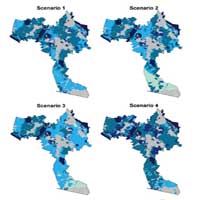
Land take is a process of land-use change in which the agricultural and natural land is taken by residential, industrial, infrastructure and other developments. This change causes the loss of a non-renewable resource, such as the agricultural/natural soil, and the relative natural, cultural and landscape resources. The growing awareness about the loss of ecosystem services related to land take led developed countries to try to reduce the quantity of land taken with new laws and regulations. The European Union has set the goal of zero land take by 2050. It is not only a problem of limiting and slowing down the phenomenon, but it is always clearer that the quality of the land taken has to be assessed and adequately considered during the land-use planning process. In fact, in some cases like in the Lombardy Region, the law focuses not only on reducing the amount of land take, but also on limiting the loss of land with high qualities, requiring municipalities to assess the productive, naturalistic and landscape qualities of the territory. In this paper, the authors develop, using the geographical information system technology, a methodology to define and calculate a composite land quality index (LQI). The methodology has been applied to a case study in the Lombardy region and has allowed to assess the quality of the territory in a rigorous and transparent way using available official data. In order to take into account the relative importance that stakeholders and land-use planners can give to the different components of LQI, analytic hierarchy process has been performed ad 4 different scenarios have been developed. LQI can support the land-use planning process in an ex-ante evaluation of different transformations hypotheses and in the definition of quality-based quantitative thresholds and monitoring of their trend over the time.

Dimensions

Altmetric

PlumX Metrics

Downloads

Download data is not yet available.

Citations

Crossref
Scopus
Google Scholar
Europe PMC
CRCS, 2018. Consumo di suolo, servizi ecosistemici e green infrastructures: caratteri territoriali, approcci disciplinari e progetti innovativi. Rapporto 2018. INU Edizioni, Roma, IT.
De Montis A., 2013. Implementing strategic environmental assessment of spatial planning tools. A study on the Italian Provinces. Environ. Impact Asses. 41:53-63. DOI: https://doi.org/10.1016/j.eiar.2013.02.004
De Montis A., Ledda A., Caschili S., Ganciu A., Barra M.. 2014. SEA effectiveness for landscape and master planning: An investigation in Sardinia. Environ. Impact Assess. 47:1-13. DOI: https://doi.org/10.1016/j.eiar.2014.03.002
Diti I., Tassinari P., Torreggiani D., 2015. The agri-environmental footprint: A method for the identification and classification of peri-urban areas. J. Environ. Manage. 162: 250-262. DOI: https://doi.org/10.1016/j.jenvman.2015.07.058
European Union, 2013, Decision No 1386/2013/EU of the European Parliament and of the Council of 20 November 2013 on a General Union Environment Action Programme to 2020 ‘Living well, within the limits of our planet’. Official Journal of the European Union L 354/171.
Fabos J.G., 1978. The Metland Landscape Planning Process: Composite Landscape Assessment, Alternative Plan Formulation and Plan Evaluation, Researh Bullettin n. 653, University of Massachusetts, Amherst, USA.
Ferrario P., Fumagalli N., Senes G., Toccolini A., 2014. Composite assessment of productive, protective and recreational functions in forest planning. Environ Eng Manag J. 13/5: 1277-1290. DOI: https://doi.org/10.30638/eemj.2014.134
Geneletti D., Biasiolli A., Morrison-Saunders A., 2017. Land take and the effectiveness of project screening in Environmental Impact Assessment: Findings from an empirical study, Environ. Impact Asses. 67: 117-123. DOI: https://doi.org/10.1016/j.eiar.2017.08.008
ISPRA, 2018. Consumo di suolo, dinamiche territoriali e servizi ecosistemici. ISPRA, Roma, IT.
Regione Lombardia, 2008, D.G.R. 19 settembre 2008 n. 8/8059, Criteri per la definizione degli ambiti destinati all’attività agricola di interesse strategico nei Piani Territoriali di Coordinamento Provinciale, BURL 29 settembre 2008.
Regione Lombardia, 2014, Legge Regionale 28 novembre 2014 n. 31, Disposizioni per la riduzione del consumo di suolo e per la riqualificazione del suolo degradato, BURL 1 dicembre 2014.

How to Cite

Senes, G. (2020) “Definition of a land quality index to preserve the best territories from future land take. An application to a study area in Lombardy (Italy)”, Journal of Agricultural Engineering, 51(1), pp. 43–55. doi: 10.4081/jae.2020.1006.

Similar Articles

1 2 3 4 5 6 7 8 9 10 > >> 

You may also start an advanced similarity search for this article.