Multi-temporal geomorphometric analysis to assess soil erosion under different tillage practices: A methodological case study
Published:31 March 2022
Abstract Views: 1043
PDF: 469
Appendix: 117
HTML: 42
Publisher's note
All claims expressed in this article are solely those of the authors and do not necessarily represent those of their affiliated organizations, or those of the publisher, the editors and the reviewers. Any product that may be evaluated in this article or claim that may be made by its manufacturer is not guaranteed or endorsed by the publisher.

Authors

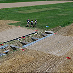
Soil erosion is one of the main environmental threats to sustainability and crop productivity in the agricultural sector. In agricultural fields, no-till management is considered a key approach for mitigating soil erosion. The measurement of soil erosion is particularly challenging, especially when surficial morphological changes are relatively small. Conventional experiments are commonly time-consuming and labour-intensive in terms of both field surveys and laboratory methods. On the other hand, the structure from motion (SfM) photogrammetry technique has enhanced the experimental activities by enabling the temporal evolution of soil erosion to be assessed through detailed micro-topography. This work presents a multitemporal quantification of soil erosion, using SfM through uncrewed aerial vehicles (UAV) survey for understanding the evolution of no-till (NT) and conventional tillage (CT) in experimental plots. Considering that morphological changes at the plot scale had millimetre orders of magnitude, it was necessary to minimise SfM errors (e.g., co-registration and interpolation) in volumetric estimates to reduce noise as much as possible. Therefore, a methodological workflow was developed to analyse and identify the effectiveness of multi-temporal SfMderived products, e.g., the conventional difference of digital terrain models (DoDs) and the less used differences of meshes (DoMs), for soil volume computations. We validated the erosion volumetric changes calculated from the SfM outputs with the amount of soil directly collected through conventional runoff and sediment measurements in the field. In this way, we recognised the most suitable estimation method. This study presents a novel approach for using DoMs instead of DoDs to describe the microtopography changes and sediment dynamics accurately. Another key and innovative aspect of this work often overlooked in soil erosion studies, was identifying the contributing sediment surface by delineating the channels potentially routing runoff directly to water collectors. The sediment paths and connected areas inside the plots were identified using a multi-temporal analysis of the sediment connectivity index for achieving the volumetric estimates, using DoMs (e.g., 2213 cm3 for no-till management system - NT and 38155 cm3 for conventional tillage regime - CT during September 2018-June 2020) that showed mild overestimation respect to field measurements results (e.g., 2359 cm3 for NT and 4525 cm3 for CT in the same period). This difference was attributable to other factors (e.g., the soil compaction processes) or variables rather than to photogrammetric or geometric ones. The developed workflow enabled low cos quantification of soil erosion dynamics for assessing the mitigation effects of no-till management that can also be extended in the future to different scales, based on SfM and UAV technologies.

Dimensions

Altmetric

PlumX Metrics

Downloads

Download data is not yet available.

Citations

Crossref
Scopus
Google Scholar
Europe PMC
Balaguer-Puig M., Marqués-Mateu Á., Lerma J.L., Ibáñez-Asensio S. 2018. Quantifying small-magnitude soil erosion: Geomorphic change detection at plot scale. L. Degrad. Dev. 29:825-34.
Balaguer-Puig M., Marqués-Mateu Á., Lerma J.L., Ibáñez-Asensio S. 2017. Estimation of small-scale soil erosion in laboratory experiments with structure from motion photogrammetry. Geomorphology. 295:285-96.
Barnhart T.B., Crosby B.T. 2013. Comparing two methods of surface change detection on an evolving thermokarst using high-temporal-frequency terrestrial laser scanning, Selawik River, Alaska. Remote Sens. 5:281337.
Cândido B.M., Quinton J.N., James M.R., Silva M.L.N., de Carvalho T.S., de Lima W., Beniaich A., Eltner A. 2020. High-resolution monitoring of diffuse (sheet or interrill) erosion using structure-from-motion. Geoderma. 375:114477.
Carretta L., Tarolli P., Cardinali A., Nasta P., Romano N., Masin R. 2021. Evaluation of runoff and soil erosion under conventional tillage and no-till management: a case study in northeast Italy. Catena 197:104972.
Carrivick J.L., Smith M.W., Quincey D.J. 2016. Structure from motion in the geosciences. John Wiley & Sons, Ltd, Chichester, UK.
Cavalli M., Trevisani S., Comiti F., Marchi L. 2013. Geomorphometric assessment of spatial sediment connectivity in small Alpine catchments. Geomorphology. 188:31-41.
Chaplot V., Darboux F., Bourennane H., Leguédois S., Silvera N., Phachomphon K. 2006. Accuracy of interpolation techniques for the derivation of digital elevation models in relation to landform types and data density. Geomorphology 77:126-41.
Crema S., Cavalli M. 2018. SedInConnect: a stand-alone, free and open source tool for the assessment of sediment connectivity. Comput. Geosci. 111:39-45.
Cucchiaro S., Cavalli M., Vericat D., Crema S., Llena M., Beinat A., Marchi L., Cazorzi F. 2018. Monitoring topographic changes through 4D-structure-from-motion photogrammetry: application to a debris-flow channel. Environ. Earth Sci. 77.
Cucchiaro S., Fallu D.J., Zhang H., Walsh K., Van Oost K., Brown A.G., Tarolli P. 2020a. Multiplatform-SfM and TLS data fusion for monitoring agricultural terraces in complex topographic and landcover conditions. Remote Sens. 12:1946.
Cucchiaro S., Maset E., Cavalli M., Crema S., Marchi L., Beinat A., Cazorzi F. 2020b. How does co-registration affect geomorphic change estimates in multi-temporal surveys? GIScience Remote Sens. 57:611-32.
Di Stefano C, Ferro V, 2017. Testing sediment connectivity at the experimental SPA2 Basin, Sicily (Italy). L. Degrad. Dev. 28:1992-2000.
Di Stefano C., Ferro V., Palmeri V., Pampalone V. 2017. Measuring rill erosion using structure from motion: A plot experiment. Catena 156:383-92.
Di Stefano C., Palmeri V., Pampalone V. 2019. An automatic approach for rill network extraction to measure rill erosion by terrestrial and low-cost unmanned aerial vehicle photogrammetry. Hydrol. Process. 33:1883-95.
Eltner A., Baumgart P., Maas H.-G., Faust D. 2015. Multi-temporal UAV data for automatic measurement of rill and interrill erosion on loess soil. Earth Surf. Process. Landforms 40:741-55.
Eltner A., Kaiser A., Castillo C., Rock G., Neugirg F., Abellán A. 2016. Image-based surface reconstruction in geomorphometry-merits, limits and developments. Earth Surf. Dyn. 4:359-89.
Gessesse G.D., Fuchs H., Mansberger R., Klik A., Rieke-Zapp D.H. 2010. Assessment of erosion, deposition and rill development on irregular soil surfaces using close range digital photogrammetry. Photogramm. Rec. 25:299-318.
Hänsel P., Schindewolf M., Eltner A., Kaiser A., Schmidt J. 2016. Feasibility of high-resolution soil erosion measurements by means of rainfall simulations and SfM photogrammetry. Hydrology 3:1-16.
Heritage G.L., Milan D.J., Large A.R.G., Fuller I.C. 2009. Influence of survey strategy and interpolation model on DEM quality. Geomorphology 112:334-44.
Höhle J., Höhle M. 2009. Accuracy assessment of digital elevation models by means of robust statistical methods. ISPRS J. Photogramm. Remote Sens. 64:398-406.
James M.R., Robson S. 2012. Straightforward reconstruction of 3D surfaces and topography with a camera: Accuracy and geoscience application. J. Geophys. Res. Earth Surf. 117:1-17.
James M.R., Robson S., D’Oleire-Oltmanns S., Niethammer U. 2017a. Optimising UAV topographic surveys processed with structure-from-motion: Ground control quality, quantity and bundle adjustment. Geomorphology 280:51-66.
James M.R., Robson S., Smith M.W. 2017b. 3-D uncertainty-based topographic change detection with structure-from-motion photogrammetry: precision maps for ground control and directly georeferenced surveys. Earth Surf. Process. Landforms 42:1769-88.
Kaiser A., Erhardt A., Eltner A. 2018. Addressing uncertainties in interpreting soil surface changes by multitemporal high-resolution topography data across scales. L. Degrad. Dev. 29:2264-77.
Lague D., Brodu N., Leroux J. 2013. Accurate 3D comparison of complex topography with terrestrial laser scanner: application to the Rangitikei canyon (N-Z). ISPRS J. Photogramm. Remote Sens. 82:10-26.
Lane S.N., Westaway R.M., Hicks D.M. 2003. Estimation of erosion and deposition volumes in a large, gravel-bed, braided river using synoptic remote sensing. Earth Surf. Process. Landforms 28:249-71.
Li Z., Zhu C., Gold C. 2004. Digital terrain modeling, distributed hydrologic modeling using GIS. CRC Press, Dordrecht.
Marteau B., Vericat D., Gibbins C., Batalla R.J., Green D.R. 2017. Application of Structure-from-Motion photogrammetry to river restoration. Earth Surf. Process. Landforms 42:503-15.
Mauri L., Straffelini E., Cucchiaro S., Tarolli P. 2021. UAV-SfM 4D mapping of landslides activated in a steep terraced agricultural area. J. Agric. Eng. 52:1130.
Morgan R.P.C. 2009. Soil erosion and conservation. John Wiley & Sons, New York, NY, USA.
Nourbakhshbeidokhti S., Kinoshita A.M., Chin A., Florsheim J.L. 2019. A workflow to estimate topographic and volumetric changes and errors in channel sedimentation after disturbance. Remote Sens. 11:rs11050586.
Parsons A.J. 2019. How reliable are our methods for estimating soil erosion by water? Sci. Total Environ. 676:215-21.
Pineux N., Lisein J., Swerts G., Bielders C.L., Lejeune P., Colinet G., Degré A. 2017. Can DEM time series produced by UAV be used to quantify diffuse erosion in an agricultural watershed? Geomorphology 280:122-36.
Prosdocimi M., Burguet M., Di Prima S., Sofia G., Terol E., Rodrigo Comino J., Cerdà A., Tarolli P. 2017. Rainfall simulation and structure-from-motion photogrammetry for the analysis of soil water erosion in Mediterranean vineyards. Sci. Total Environ. 574:204-15.
Reconstructor Gexcel, 2021. Online Help Reconstructor 4. Available from: https://help.gexcel.it/reconstructor/v4/CutFillCalculation.html. Accessed: 1 September 2021.
Schuller P., Walling D.E., Sepúlveda A., Castillo A., Pino I. 2007. Changes in soil erosion associated with the shift from conventional tillage to a no-tillage system, documented using 137Cs measurements. Soil Tillage Res. 94:183-92.
Tarolli P., Cavalli M., Masin R., 2019. High-resolution morphologic characterization of conservation agriculture. Catena 172:846-56.
Wang B., Shi W., Liu E. 2015. Robust methods for assessing the accuracy of linear interpolated DEM. Int. J. Appl. Earth Obs. Geoinf. 34:198-206.
Wang L., Dalabay N., Lu P., Wu F. 2017. Effects of tillage practices and slope on runoff and erosion of soil from the Loess Plateau, China, subjected to simulated rainfall. Soil Tillage Res. 166:147-56.

How to Cite

Cucchiaro, S. (2022) “Multi-temporal geomorphometric analysis to assess soil erosion under different tillage practices: A methodological case study”, Journal of Agricultural Engineering, 53(1). doi: 10.4081/jae.2022.1279.

Similar Articles

1 2 3 4 5 6 7 8 9 10 > >> 

You may also start an advanced similarity search for this article.